Wednesday, September 3, 2008

The Final Post (as promised)

Final Thoughts


Here it is. The long awaited final thoughts from my 55 day epic adventure of cycling across the continent. Easily the most frequent question that I’ve been asked since returning home has been, “What was the toughest part?” It seems to be the most important question a person can ask, as if that one crucial difficult task is what is preventing more people from doing it. Well, I’ve given it a lot of thought over the past month. I’ve thought about all the hills, the weather, the sleeping in tents. It was all tough in its own right, but the singular toughest part of the entire ride was… getting to the starting line. Getting myself mentally ready to embark on this seemingly unachievable thing. My stomach was tied in knots in the days leading up to the start date. “Did I pack the right things? Am I in good enough shape? What if I get lost?” All of those thoughts just about made back out from even starting this thing. But I was bound to do this, one way or another. I had prepared enough and I was as ready as anyone who has done this before me. I just needed to get myself out the door.


I came the closest to quitting when Chancy decided to go home because of a family emergency. There’s no way I would have actually quit, but I really didn’t want to continue alone. Fortunately I met a guy named Nick who came around to the right place at the right time and said just the right things about his own cross country adventures by bicycle which spurred me on to where I was even looking forward to setting out solo across this great nation.


A number of phrases went through my head on my bike trip from America’s great patriotic songs. “From sea to shining sea,” on both the Atlantic and Pacific Oceans. “Oh Beautiful, for spacious skies,” in Missouri and Montana. “Amber waves of grain,” as the sun would set throughout Kansas, and “Purple mountain majesty” in the beautiful Rockies of Colorado and Wyoming. It was all there in front of me as I peddled across the country.


I ate countless numbers of hamburgers and fries from all the local mom and pop restaurants. I met friendly people all along the way, both the restaurant owners and patrons as well as the other bicyclists. If you ever see a bicyclist eating a meal in a restaurant or taking a breather outside a gas station, ask them where they are going or where they’ve come from or how many miles they’ve biked so far. They would love to tell you about their travels and you would just as equally love to hear them. It only takes a moment to ask.


I loved the Rocky Mountains. I had never seen them before and was more than mildly surprised to see that they still had snow atop the high elevations. The bitter cold mornings in the Rockies surprised me and gave me cause to start my days at 8 or 9 rather than 6. I loved the sun shining on open highways with a gentle breeze at my back as the horizon presented new, unseen adventures of what they day was to behold. Each town had its own quirkiness. Each town had its own claim to fame whether it was the whiskey capital of the world or if it housed the world’s largest ball of barbed wire. Some towns were once booming gold mining towns and others were college towns. But they were all America. They all represented the woven fabric of what makes America unique.


Whenever I would ask someone what they thought of their town, I would usually get the same response. “It’s boring. There’s nothing to do here.” Which led me to think, “Huh. That sounds like where I’m from,” which further led me to realize that it’s not the town that makes a place special, it’s the people within the town who are actively pursuing a greater town, a greater community, which makes a place a great town where people want to be. Like the town of Baker City, OR where the downtown was a happening place, in part because they had fought to keep Wal-Mart and similar stores away which enabled and empowered downtown businesses to continue to do business. It meant that people would have to pay a little bit more for their goods and they wouldn’t find things all in the same place, but it enabled those family businesses to remain intact and it employed people that bigger super stores tend to put out of business.


So that was my impression of the bike trip. Would I do it again? In a heartbeat! Will I do it again? I certainly hope so!


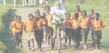
There is still a need to raise more money for the kids in Uganda. The community center building which is being built with the funds raised for this bike trip is to be used by the Compassion International kids once a week when they come for their supplemental education on Saturdays. It will also be used by the 2 schools as well as the church which are all located together there on the hill of my village. Due to increasing food prices, increasing gas prices, and because of the December ’07 riots in Kenya there is a need to raise additional money to complete the building! I hope to post pictures soon of the progress of the building. I spoke with them recently and they are working on getting the roof onto the structure.


If you have been following me on this cycling adventure and have enjoyed it even a little bit and would be able to help this amazing cause and these amazing, amazing kids, then please consider even a small donation to this great cause. It takes a few people taking action and deciding to give, to sacrifice. When just a few people do that, then buildings in Uganda get built and communities are changed. Please, just take a moment to consider what you can do to help.


Thank you all for taking this journey with me!! I appreciate all of the encouragement along the way as well as the number of people who have told me that they enjoyed “following me” on my journey and miss their daily bike trip with me.


Below I’ve included some statistics from the trip, and beneath that my highlights of the trip.


Number of days on the bike: 55
Number of days off (no distance gained): 2

Number of 100+ mile days: 19
Starting point: Yorktown, Virginia
Ending point: Astoria, Oregon
Total distance traveled: 4581.7 miles

Straight line distance from Yorktown, VA to Astoria, OR: 2,478 miles
Average daily riding distance: 83.3 miles
Total amount of climbing (add up the height of all the hills): 201,465 feet
Approximate number of pedal turns: 1.7 million
Approximate energy intake each day: 4000–5000 Calories
Number of times each bike wheel went 'round and 'round: 2,160,000
Number of times the trailer wheel went 'round and 'round: 2,750,000
Maximum altitude: 11,529 feet (3514 m) above sea level (Hoosier Pass in central Colorado)
Minimum altitude: 0 feet (both coasts)
Typical weight of bike, trailer and gear: 90 pounds
Average speed: 11.4 mph
Total time on the bike: 23,114 minutes (385.2 hours OR 16.0 continuous days)
Average ride time each day: 7 hours, 42 minutes
Number of states: 10
Number of time zones: 4
Number of times I crossed the continental divide: 10
Number of flat tires: 9
Distance traveled before first flat tire on bike: 25 miles
Number of tires I wore out: 3
Number of days I rode solo: 33
Number of days I rode with at least one other person: 22
Number of people I rode with: 3
Person I rode with the longest: Pat McLaughlin (18 days)
Lowest temperature encountered: 35°F
Highest temperature encountered: 104°F
Number of other cyclists I encountered riding recumbents: 3


· Historic Yorktown, Jamestown, Williamsburg

· AA Meeting

· Civil War Battlefields

· Free Honey

· Swimming in Lake Anna after a hot day of cycling

· Chancy going home and meeting Nick

· The Cookie Lady

· Chris in Lexington, VA, owner of “Sweet Things Ice Cream Shoppe” a former lawyer who, “used to ruin peoples‘ lives with divorces… now I make ice cream.”

· People gathered around my “funny looking bike”

· Natural Bridge, VA

· Cecil, the city park director, who, after I told him I biked 100 miles that day, said “Nobody does that kind of mileage to get here. Not even the young, strapping ones like yourself.”

· From my blog: “It’s great to be doing this. Outside. On a bike. Great exercise. Sun shining. Listening to the birds, watching deer cross my path, hearing the bubbling brook I’m cycling next to.”

· Entering Kentucky, which I thought would never happen!

· Being chased by dogs in Kentucky.

· Kentucky: 4 wheelers, liquor stores, trailer homes and lawn ornaments.

· The breakfasts along the way were GREAT!!

· Kentucky hospitality and the family I camped with outside of their country store near Hudson, KY.

· I hate State Parks! State Parks = hills!

· A shower at the end of the day is worth its weight in gold

· The ferry ride across the Ohio river into Illinois

· Listening to my podcasts

· Meeting up with my friend Ashby in Farmington, MO

· Meeting up with Pat in Farmington, MO who I would ride with for the next several weeks

· Bathing in the clear, cool water of the Current River in the Missouri Ozarks

· Swimming in a rock quarry on a hot afternoon

· The flatness of Kansas and the smell of fresh cut hay.

· The barren, emptiness of Kansas

· Stepping on a nail

· “Mom’s Bar & Diner” in Seward, KS, where the streets are paved with… dirt

· Riding through Rush County, KS (I’m from Rush County, IN)

· The hotel at Ness City, KS that let us swim and shower there for free even though we weren’t staying the night there.

· Cycling with my friend Mark through parts of Kansas, Colorado and Wyoming

· Cycling 175 miles in one day!!!

· Meeting up with my friends Carol and Sherry in Colorado

· The Colorado Rocky Mountains

· Freezing temperatures in the wee hours of the morning

· Meeting John and Little John, the father and 12 year old son biking across the country, as well as meeting mother and daughter in the support vehicle.

· Alma, CO, the highest city in America

· Hoosier Pass, the highest point along the trail (11,539 ft)

· Our “secret” camping spot in Saratoga, WY and the hot springs there in the town

· Writing our names on the walls of the convenience store in Muddy Gap, WY and seeing that someone from Shelbyville, IN had been there

· My favorite sign “6% Downhill Grade – Next 17 Miles”

· Jackson, WY and the Teton Mountains

· The Japanese volunteers that I met at Yellowstone Park, Nozomi and Yoko

· Quake Lake where an earthquake and landslide in 1957 created a new lake and stranded several hikers and campers in the area and killed several others.

· Virginia City, MT where I saw a play

· Highway 12 along the Lochsa River near Lolo Hot Springs

· Baker City, OR where I took a day off to sightsee along the Oregon Trail

· The Lava Rocks on top of McKenzie Pass (and the road construction workers who made me wait 6 hours to pass)

· Eugene, OR and Hayward Field on the University of Oregon and running a lap around the track.

· The Oregon Coast where I almost cried

· Astoria, OR, the finish line of my trip, and my friend Amber and her mom and aunt there to meet me.

Wednesday, August 6, 2008

Day 55, Astoria at last!

Day 55, Cape Lookout State Park, OR – Astoria, OR 77 miles (4250 total)

August 4, 2008

Time on bike: 7:19:04

Avg: 10.5

Daily Ascent: 3566 ft (46 ft/mi)

Elevation at days end: 0 ft

Max: 34.5 mph

Astoria at last! The last day of the trip. 77 miles to Astoria. The day was tough. 2 flat tires. A total of 6 flat tires in the past 4 days. There was a great deal of traffic along highway 101 and a lot of glass in the shoulder. I ran over nails and staples in the road. On a positive note, I did run into my friends Melody and Morgan who were driving the support car for John and Little John, the 12 year old boy and his father who were biking the trip. I hadn’t seen them since Baker City, OR and hadn’t talked to them since Wyoming. John and John were 15 miles ahead of me.

I was going to stop for lunch but I was just 25 miles from Astoria and I couldn’t bring myself to stop with just over 2 hours of biking to go, so I pushed ahead. I thought I’d be ok but about 10 miles out I started to crash from lack of energy. I came around the last turn and saw the bridge that was going to take me into Astoria. Just as I reached the foot of the long bridge I stopped. Another flat tire! I debated for a moment whether to fix the flat or just walk the bike in. I opted to walk. I limped into Astoria like a wounded soldier returning from battle. Hungry and tired, I looked for a place to eat. I had hoped for a nice big order of baby back ribs. Instead, I walked my injured bike to Diary Queen and ordered a double cheese burger, chicken sandwich, fries, a coke and a hot fudge Sunday.

My friend, Amber Smith, drove down from Washington with her mom and aunt to meet me in Astoria. We went to the Astoria sign to take some pictures as well as to the beach. It was really incredible to have someone in Astoria to meet me upon my finish. It was a great ending to a really great trip.

In my last blog I’ll touch on the highlights of the past 55 days of the trip.

Monday, August 4, 2008

Day 54, The Pacific Coast At Last!

Day 54, Corvallis, OR – Cape Lookout State Park, OR 113 miles (4173 total)

August 3, 2008

Time on bike: 9:47:56

Avg: 11.5

Daily Ascent: 5427 ft (48 ft/mi)

Elevation at days end: 5 ft

Max: 40 mph

The Pacific Coast at last! So, after 54 days of cycling nearly 90 miles a day, I finally did reach the Pacific coast! Wow! What words can be spoken after such an epic adventure? I was speechless to say the least and I very nearly cried. I wanted to jump off my bike and immerse myself in the crashing waves! I wanted to leap for joy! I wanted to do a little victory dance on the side of the road. Instead, I sat on the wall of the ‘scenic viewing area’ and just smiled as the reflection of the setting sun glanced off the white capped waves. Thoughts of my grandparents went through my mind as I ate one of my grandma’s favorite cookies, one of those raspberry filled ones. I thought of Uganda and the kids there that I’m raising this money for. I thought of the settlers crossing this country for months on end to reach the promise of a new life. I thought of my parents and family and of the support they’ve given me throughout this ordeal, and of the countless friends who have sent me words of encouragement. It’s been an amazing ordeal!

I camped at Cape Lookout State Park which is a long, skinny peninsula which juts out into the ocean. It’s lined with tall pine trees and is just a stone’s throw from the ocean. I had another flat tire, my 4th in 3 days, but nothing could deter me from reaching the ocean. I’ll cycle 1 more day to reach my final destination of Astoria, OR before boxing up my bike to ship it home and then flying home myself.

Sunday, August 3, 2008

Day 53, Track Town, USA

Day 53, McKenzie Bridge, OR - Corvallis 111 miles (4060 total)

August 2, 2008

Time on bike: 8:44:33

Avg: 12.7

Daily Ascent: 1939 ft (17 ft/mi)

Elevation at days end: 200 ft

Max: 31.5 mph

From Bust to Boom! If yesterday was one of the crappiest days on a bike where I had to sit and wait some 6 hours for a power hungry road crew to let me pass, then today was a day I won’t likely ever forget!

I cycled into Eugene, Oregon, home of the University of Oregon. Eugene is also known as “Track Town, USA” because of the success of long time track coach, Bill Bowerman, beginning in 1949, and to the many legendary UO track athletes, notably Steve Prefontaine and Alberto Salazar. Hayward Field is a mecca of sorts for distance runners.

I reached Hayward Field and noticed some track events going on. There were just a few people in the stands and I wondered what exactly was going on. The front gate was locked but the side gate was open, so I cycled in. I was immediately met by a couple wearing stopwatches around their necks. I would later learn that this was Bill and Marcia McChesney, both celebrated distance runners. Bill, who is now 80, still runs 40 miles a week. In1981 Bill set an American and World record for 53 year old men in the mile with a 4:51.5. In the same meet, his son, Bill Jr. broke the four-minute barrier in the mile event. Bill Jr. They were track officials for this meet which was a masters division track meet with all of the events of a normal track meet. Masters are 40+ year old athletes. Some of the athletes competing were will into their 80s! Bill and Marcia invited me down to the start/finish line where I chatted away with them while the events were going on. We talked about my bike trip and about cycling and running. I asked if I could run a lap around the track and they said it’d be fine.

Unbelievable! I ran a memorable lap around the track at the University of Oregon, Hayward Field! Where some of the most amazing runners of all time have poured out their heart and soul and gutted out some of the greatest track times ever! I also met others as well. I met Bob and Wayne there as well and had memorable conversations with them too. Wayne and I, while in the men’s room underneath the grandstands, got to talking. He had just participated in the hammer throw and shot put competitions where he did quite well. The conversation went from that to biking to accomplishing things in life to Jesus and church. Who would have thought that I’d be talking Jesus and church in the men’s room underneath the grandstands at Hayward Field… Unbelievably neat!

The whole day was just fantastic, in large part due to my time at the track. The folks there just took me right in and we had such a great time and in such an amazing place. The track had been renovated just prior to the US Olympic Trials which were held there just a few weeks prior.

I ended my trip in Corvallis, OR where I spent the night (somewhat illegally) in the city park. I should reach the coast today (exciting!) and I’ll reach Astoria by Monday evening!

Saturday, August 2, 2008

Day 52, A long day indeed

Day 52, Redmond, OR – McKenzie Bridge, OR 64 miles (3949 total)

August 1, 2008

Time on bike: 5:59:09

Avg: 10.7

Daily Ascent: 2855 ft (45 ft/mi)

Elevation at days end: 1400 ft

Max: 32 mph

A really tough day. I was supposed to meet up with my friend Dan in McKenzie Bridge, OR at 3:40, so I woke extra early to get my miles in. I figured I’d be over McKenzie Pass and in town by noon to relax until I met up with Dan. McKenzie Pass is significant for several reasons. First, it’s a challenging climb, up 2,000 feet over 15 miles. Secondly, it’s the last real ‘climb’ of the trip. Elevation is over 5,000 feet and after that I don’t reach over 1,000 feet in elevation again.

I began the climb excited that there was no traffic on the road, much to my surprise. The road was a smallish road with no shoulder. A few bicyclists passed me and I finally asked one of them if the road was open ahead. I heard there was a land slide and the road had been closed. “It’s closed but they sometimes let bikers through. Just depends on what they’re doing. They’re logging and if they’re not cutting trees they’ll let you pass.” I was over halfway up by this point so I figured it was worth a try.

I began seeing cyclists heading back down the hill. “It must be closed,” I thought to myself. Finally I saw the guy who passed me and he shook his head no. “Oh well, I’ve come this far, maybe they’ll let me pass.” I stopped at an overlook near the top and met another cyclist name Jonathan. We talked for a while before riding up together.

We reached the roadblock and went around and eventually came to the crane and I saw one of the loggers and shrugged and pointed ahead to ask if we could continue. “Go ahead!” he said, “and thanks for going slow.” So Jonathan and I soon reached McKenzie Pass. It was gorgeous. It was very barren, covered with lava rocks and almost no trees or growth. There was an observatory which resembled a small castle which was built when they built the road. The overlook was really neat. You could get into it and then on top of it. Once in it, you could look through ‘tubes’ which pointed to the various peaks around telling which ones they were and their elevation.

Jonathan headed back down the same way he came and I headed west towards the town of McKenzie Bridge. About 5 miles into my gently sloping descent I got a flat. Talk about a gorgeous place to have a flat tire. Beautiful pines grew up all around and it was so peaceful and serene. I fixed that flat and then a few miles later another flat! Then the trouble started…

Up ahead was a work crew working on a section of the road. When I approached I could tell by the guys body language, not to mention the hunk of skoal in his lip that this wasn’t where I was supposed to be.

“You CANNOT cross here! You aren’t even supposed to be in here! You’ll have to go back!” They were working on a tiny stretch of the road, removing rocks from the surrounding hillside. “If you don’t like it, my supervisor will be here in 20 minutes.” So I waited.

An hour later the super showed up. “You CANNOT go through here! You weren’t supposed to be on this road at all. Those loggers shouldn’t have let you pass.” Water under the bridge at this point, I thought. It’s inconceivable for me to go back to where I came from, some 40 miles back. There was another road, but it was another climb up another similar hill. Just not feasible to go back. “If you could just let me through…” “Can’t happen! I’ll have to call the state police if you try it.” “I can go around, in the woods, can’t I?” “I can’t give you permission to do that, all I’m saying is that you can’t go through here!”

The terrain around where they were working was steep and with heavy undergrowth. Nearly impossible to pass on foot, not to mention carrying a heavy bike and all my gear! I started to walk through the woods to size it up when one of the road workers who was looking on said, “We’ll be done working by 3pm, why don’t you wait and cross then. Either 3 or 3:30.” It was2:30 by this point, so I decided to wait.

Three p.m. came and went. So did 3:30. Then 4. Then 5. Then 6. Then 7 and finally 7:30 before they finally wrapped up. I had waited there almost 6 hours from when I first came. Just sitting and waiting. They wouldn’t let me go through, so what was I to do. Had I known I was to wait so long I would have devised another plan, but I was waiting for what I thought would be a short time. Clearly I had miscalculated.

I finally reached McKenzie Bridge well after dark and called my friend Dan. He thought he had gotten there late and had gone ahead and ridden into Eugene which was the plan from the start. I found some food at a mini mart and then went to the campground. Of course, the campground was full so I had to search for an alternative. I found a clearing on the side of the road next to the Highway Department. There had been sand dumped there at one time, so it was soft and not visible from the road. I slept there and woke before dawn to clear out. It had certainly been a long day!

Friday, August 1, 2008

Day 51, Another long day

Day 51, Mount Vernon, OR – Redmond, OR 132 miles (3885 total)

July 31, 2008

Time on bike: 10:49:36

Avg: 12.2

Daily Ascent: 5894 ft (45 ft/mi)

Elevation at days end: 2900 ft

Max: 43 mph

I’m not sure what exactly I ate for breakfast. I ordered biscuits and gravy with poached eggs on the side. What was delivered to me was more of a corn bread texture, but not taste and the eggs were runny and not like momma fixes ‘em.

The morning ride was smooth and downhill. I stopped for a snack at Dayville where a friendly little boy told me he was in 8th grade there and that there were 12 other students in 8th grade. I spent the rest of the morning climbing a hill, finally reaching the top and then quickly descending into Mitchell. Mitchell has had a dramatic life. In 1884 a flash flood washed over the bluff above the town, acarrying away wagons and livestock and it deposited huge boulders on the towns streets. Fire hit the town twie, in 1896 and again in 1899 destroying a total of 19 buildings. The biggest disaster occurred on July 11, 1904 when a sudden cloudburst in the desert resulted in a wave of water 30 feet high which rushed down the narrow ravine in which part of the town lies. With the exception of a few buildings the entire town was destroyed. Miraculously though, only 2 people died from the event. The sound of the oncoming water was enough to warn the town.

From Mitchell I headed up the steepest pass of the day: Ochoco Pass. It was a 2,000 foot climb in about 10 miles. I climbed and climbed, all the while listening to Tony Dungy’s book, Quiet Strength, on my iPod. After a while, Tony wasn’t enough motivation so I switched to my running music and locked myself in and pushed to the top. That hill almost got me to stop, but I was bound and determined to whip it, and I did!

My friend Dan wants to meet me in Eugene but he’s unable to on Saturday, so I had to go further today than I had planned. But my body seems to be healed enough and I was able to make the extra distance without incident. I did veer off the route for a spell, though. The final leg was 25 miles, but the other road which may be more traveled was only 18. I opted for the shorter route. Wow, was I in for a surprise. When I came to the intersection to chose routes, a semi took the marked route, but I went the other way up a hill and around a corner. What I didn’t realize was that the hill kept going around the corner, up another 400 feet in elevation before leveling out some. I bet the semi driver knew the hill and opted for the flatter course! Did I learn my lesson from all this? To follow the marked route? No, I learned to follow the semi drivers!

So now I’m camped out, illegally I’m sure, just outside a baseball field in a park under some pine trees trying not to be seen. There doesn’t seem to be any camping in Redmond even though it’s a town of 20,000 people. The only camping I saw was 3 miles south of town off the route. I didn’t want to bike another 3 miles today!

Otherwise the ride was good. The roads were quiet and there was a mixture of arid sagebrush and pine trees along the road. I saw a number of deer and cows. Tomorrow is another big climb up McKenzie pass, but it’s down hill for 50 miles after that to Eugene and my friend Dan is going to bike those last 50 with me. Should be good!

Thursday, July 31, 2008

Day 50, Just another day on the bike

Day 50, Baker City, OR – Mount Vernon, OR 95 miles (3753 total)

July 30, 2008

Time on bike: 8:43:03

Avg: 10.8

Daily Ascent: 4347 ft (46 ft/mi)

Elevation at days end: 2900 ft

Max: 39.5 mph

I took the day off yesterday to get rested up. I spent my day off exploring Baker City and photographing the town as well as uploading pictures. I also visited the Oregon Trail Interpretive Center. The Oregon Trail began in 1843 and it took emigrants as long as 6 months to get from Independence, Missouri to Oregon City, Oregon. There are still wagon ruts visible near the Center.

From Baker City today there’s a 60 mile stretch without any towns, restaurants or convenience stores, with the exception of McEwen Country Store. I opted for a 3 mile detour off the route to Sumpter for a bite of lunch about 30 miles into my ride. Lunch included a salmon sandwich and a waitress who refused to let my Coke get beyond ½ empty.

After lunch I had 3 passes to climb in a 30 mile stretch. Each mile went up 1,000 feet from the valley below: Sumpter Pass, Tipton Pass and Dixie Pass. From Baker City the land was still arid and dry, covered with sagebrush, but about 15 miles past the rolling hills became covered with pine trees making it a pleasant ride. It’s amazing what adding one accessory can do to improve the whole landscape wardrobe. My ride continued through pine tree lined route 7. I did stop at McEwen’s Country Store, or at least trying to. From a ways off I could see the Coca-cola sign hanging up, but I couldn’t see the store. Only a church. Behind the church, where the sign was hanging was a house. I recognized the barn from my guidebook so I was sure this was the place where the store once was. The old barn was covered with a myriad of antlers and old rusty tools, and I mean covered! A boy of maybe 7 saw me pushing my bike up the hill and shouted inside, “Grandma, someone’s comin’.” “Is the store open?” I asked. “Grandma, is the store open? …Nope, not today, but you can get some water if you need it.” I talked to the boy for a while. His name was Lucas and he was visiting for the summer now that summer school was out. He’d never heard of Virginia, where I’d started, but he’d heard of Florida. He told me the names of the 3 dogs who were very interested in smelling me and all my stuff. Eventually “Grandma” came out. She was very friendly and I showed her the picture of her barn in my guide book. She’d never seen the picture before. It was taken 12 years ago and the barn had a new metal roof put on since then. Before it had a wooden roof. She’d been out weeding around the barn yesterday. She called her husband over to have a look at the book who had just come out of the garage. We talked about biking and about other bikers who had come through. They said they were almost all friendly except for a few. The store they opened on occasion but there just wasn’t much business. “Grandpa” talked about the friendliness of people he’d met when he’d ridden his Harley to Sturgis. He looked like a Harley rider, for sure! I wanted a picture of him just for the heck of it but was semi-afraid to ask. He actually used the word ‘bitchin’ at one point. A true Harley rider. They were both super friendly though and I could have stayed and talked to them all morning, but I had riding to do.

The road I was on was being redone with tar and gravel, so it made riding difficult. If I rode in the road it wasn’t much different than a gravel road, but the narrow shoulder where they hadn’t worked wasn’t bad.

I’m noticing veins in my legs where I didn’t even know veins were supposed to exist!

Riding today through the pine forest smelled like a Hallmark store around Christmas time.